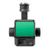
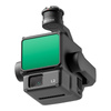


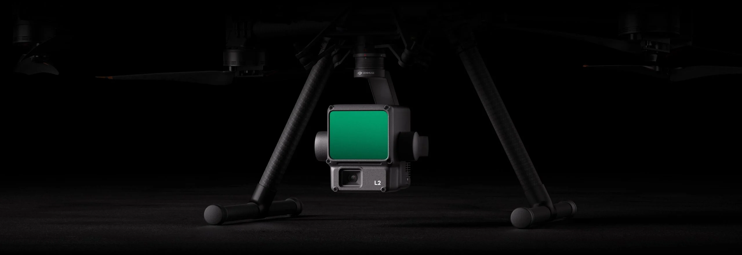
Camera DJI Zenmuse L2 + DJI Care 1 skirt
- Domyślną nazwę, opis jak i inne parametry dodawanego produktu zmienisz udając się na stronę TOWARY \ Ustawienia nowo dodawanego produktu.
Subscription products in your shopping cart
Set one delivery frequency for all subscription products in your cart every:
Subscription products in your shopping cart

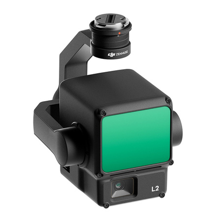
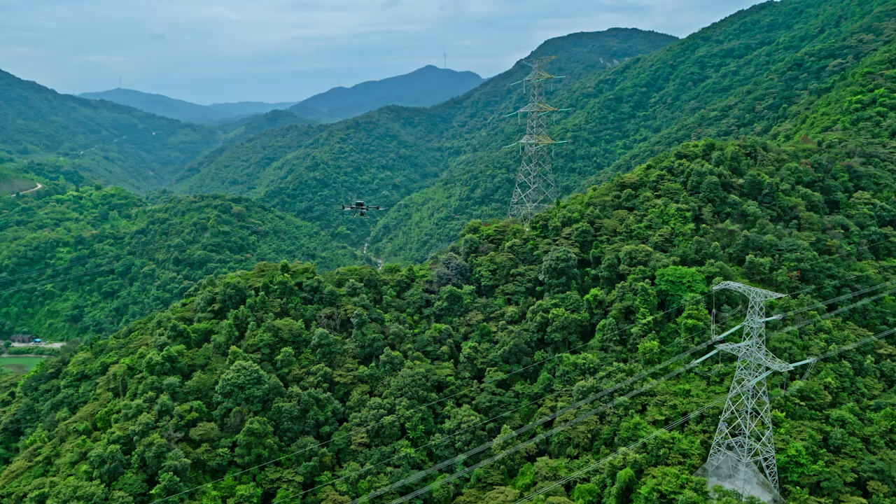
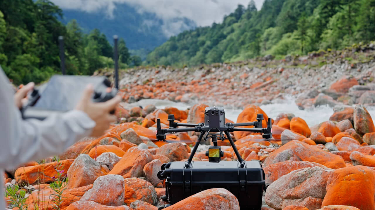
Powerful coverage and exceptional precision
The Zenmuse L2 payload combines LiDAR technology, a proprietary high accuracy IMU system and a 4/3 CMOS RGB mapping camera for even more precise, efficient and reliable geospatial data acquisition
Advanced LiDAR solution
Backed by advanced technology, the Zenmuse L2 payload allows precise scanning of complex objects over a larger area and enabling even faster point cloud creation.
High precision
Thanks to the combination of GNSS and a proprietary IMU module, measurements reach an accuracy of 4 cm vertically and 5 cm horizontally.
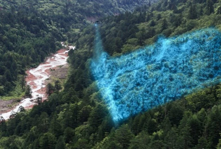
Exceptional performance
Ready to go as soon as you switch on. Collect geo-spatial and RGB data from a 2.5 km2 area in a single flight.
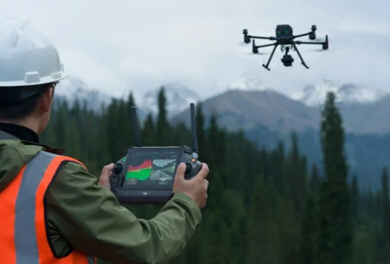
Intuitive operation
Combined with the DJI Matrice 350 RTK drone and DJI Terra software, the Zenmuse L2 LiDAR scanner offers a ready-to-use and easy-to-use solution.
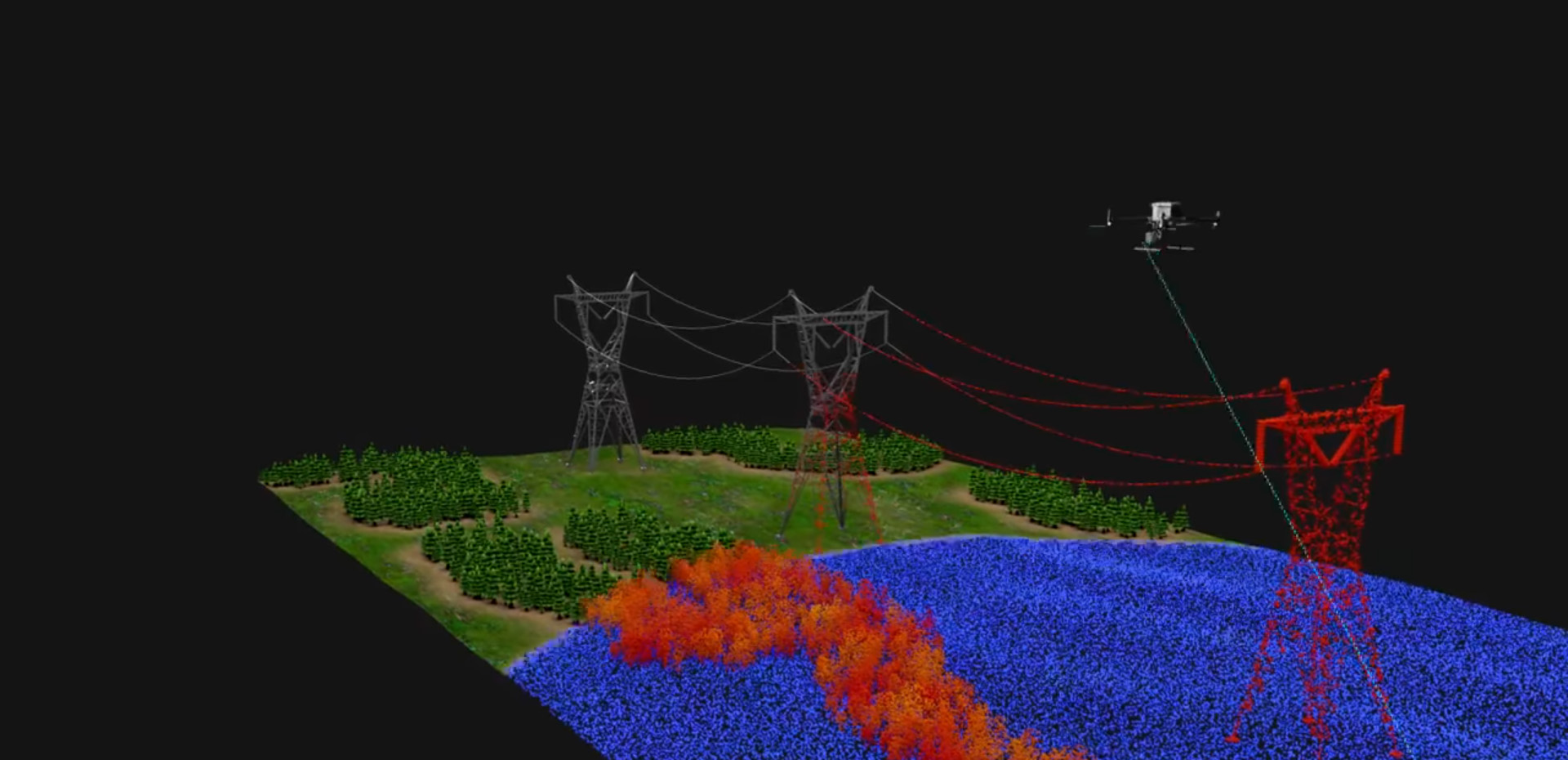
Increase detection range by 30%
The Zenmuse L2 can detect measurements from a distance of 250 metres at 10% reflectivity and 100 klx brightness and up to 450 metres at 50% reflectivity and 0 klx brightness.

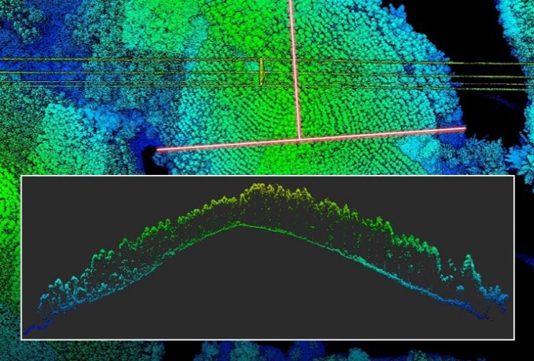
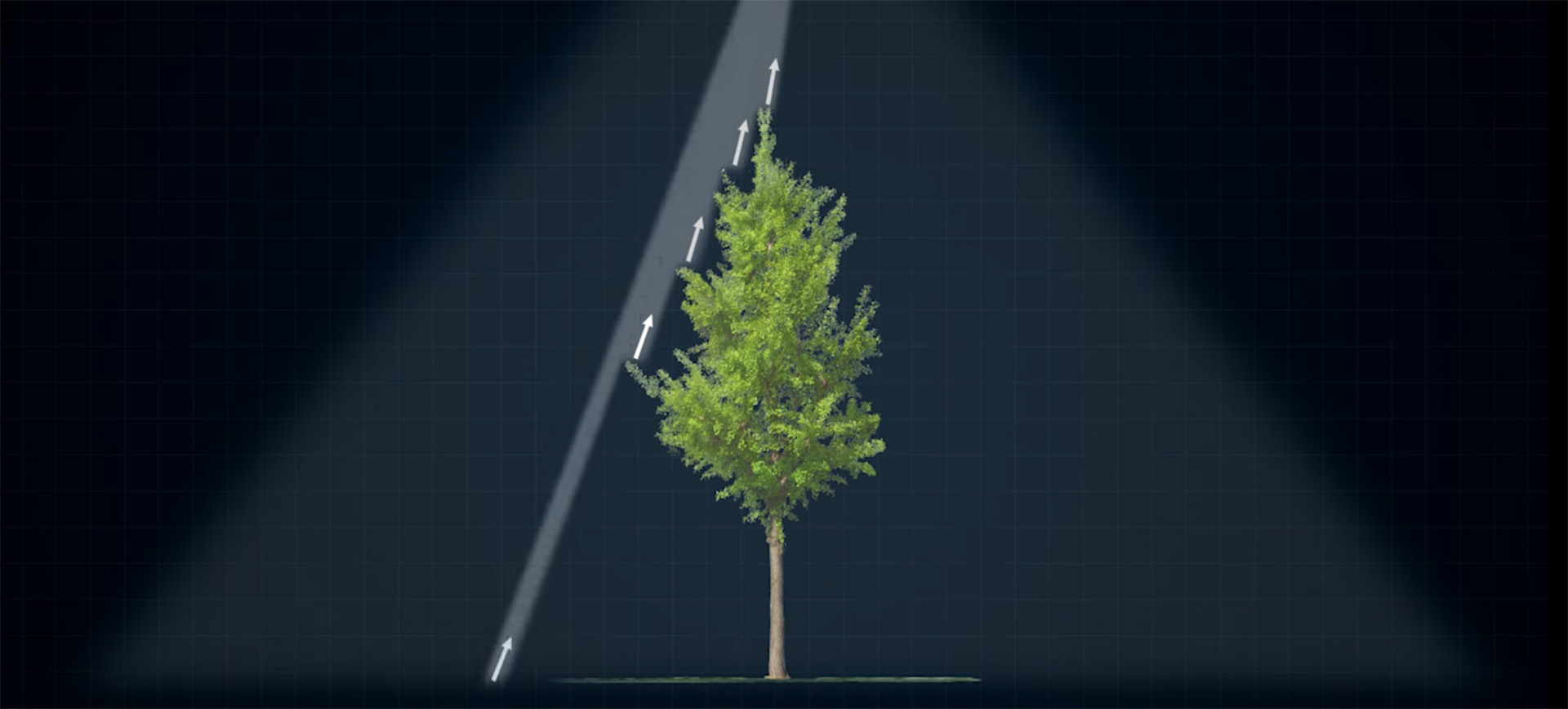
Smaller laser spot, increased point cloud density
With a reduced spot size of 4×12 cm @100 m, just one fifth of that of the Zenmuse L1, the Zenmuse L2 not only detects smaller objects with more detail, but can also penetrate denser vegetation, generating more accurate digital elevation models (DEMs).,
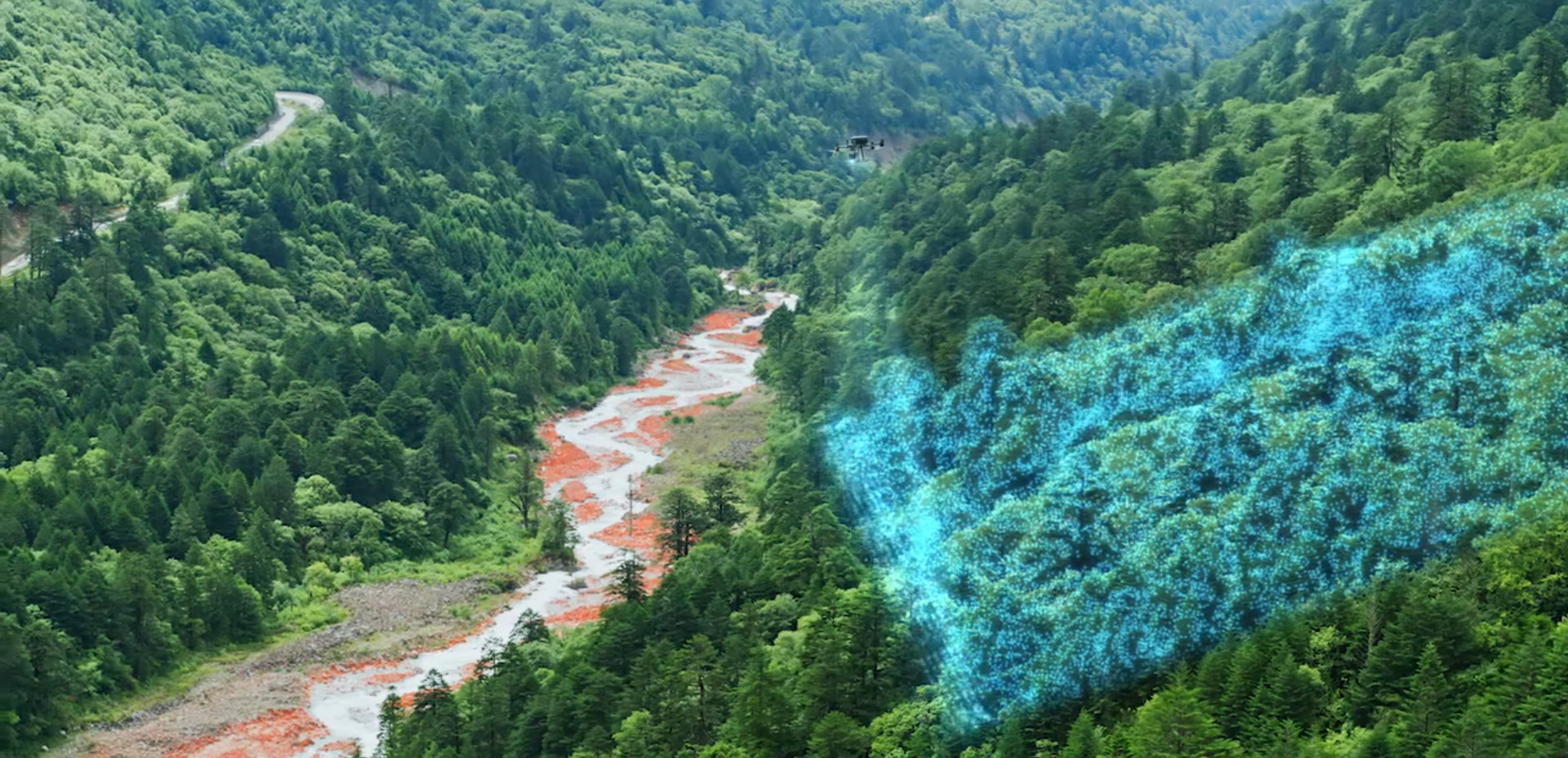
5 beam returns
In areas of dense vegetation, the Zenmuse L2 can capture more ground points beneath the foliage.
Effective sampling range 240,000 pts/sec.
In both linear (repetitive) and non-repetitive (non-repetitive) scanning modes, the Zenmuse L2 can achieve a maximum point cloud processing rate of 240,000 points per second.
2 scanning modes
In line scanning mode (repetitive scanning), more uniform and accurate point clouds can be achieved while meeting precision mapping requirements. The non-repetitive scanning mode (non-repetitive scanning) offers deeper penetration for more structural information, making it suitable for power line inspection, forest surveys and other scenarios.
Improved accuracy
The advanced high accuracy IMU system, combined with a drone equipped with an RTK positioning system, provide Zenmuse L2 with access to highly accurate absolute position, velocity and attitude information.
Immediate readiness
The performance of the IMU system has been greatly enhanced and it is ready for use as soon as the power is switched on. The drone is ready to start tasks as soon as the RTK is set to FIX status, ensuring optimised performance in the field.
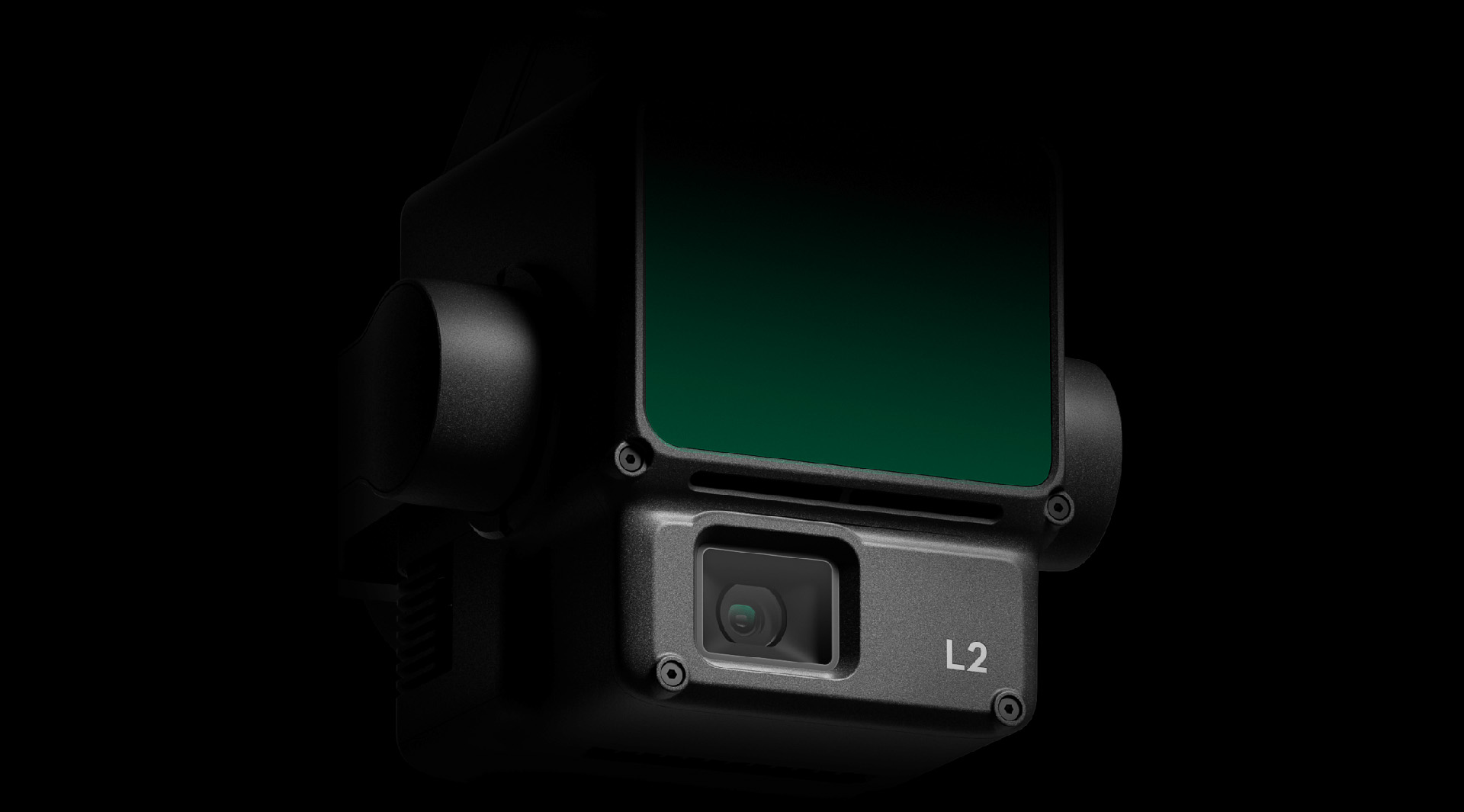
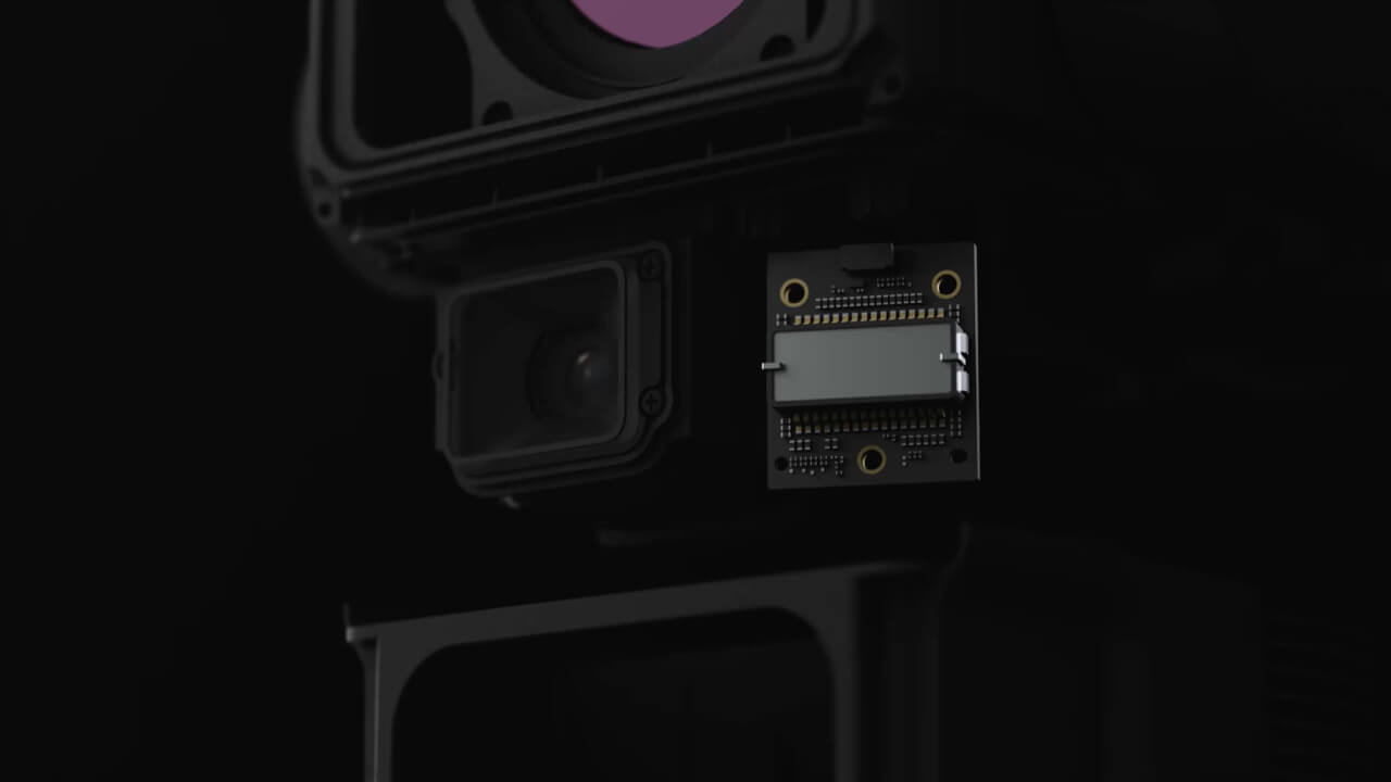
4/3" CMOS sensor, mechanical shutter
The pixel size has been increased to 3.3 μm and the effective pixel count now reaches 20 MP, resulting in a significant improvement in overall imaging, as well as greater point cloud detail in true colours.When point cloud creation is not required, the RGB camera can still take photos and videos or collect images for visible-light mapping.
Kit contents:
- Zenmuse L2
- DJI Care Enterprise Basic for 1 year (auto activation)
- DJI Terra Electricity for 3 months
- 128GB microSD memory card
- Lens hood
- Lens cleaning cloth
- Carrying case
| GENERAL | |
|---|---|
| Product name | Zenmuse L2 |
| Dimensions | 155×128×176 mm |
| Weight | 905±5 g |
| Power | 28 W (nominal) 58 W (maximum) |
| IP protection rating | IP54 |
| Compatible drones | Matrice 300 RTK (requires DJI RC Plus) Matrice 350 RTK |
| Storage temperature | -20° to 60°C |
| SYSTEM PARAMETERS | |
| Detection range | 450m at 50% reflectivity and 0 klx 250m at 10% reflectivity and 100 klx |
| Point cloud sampling range | Single beam return: max. 240,000 pts/s Multiple beam return: max. 1,200,000 pts/s |
| System accuracy | Horizontal: 5 cm @ 150 m Vertical: 4 cm @ 150 m |
| Point cloud colour assignment | Reflectance, height, distance, RGB |
| LiDAR | |
| Measurement accuracy (RMS 1σ) | 2 cm @ 150 m |
| Maximum number of laser beam returns | 5 |
| Scanning modes | Non-repetitive, Linear (Repetitive) |
| FOV | Linear scan mode (repetitive): Horizontal 70°, Vertical 3° Non-repetitive (non-repetitive) scanning mode: Horizontal 70°, Vertical 75° |
| Minimum detection range | 3 m |
| Laser beam divergence | Horizontal 0.2 mrad, Vertical 0.6 mrad |
| Laser beam wavelength | 905 nm |
| Laser spot size | Horizontal 4 cm, Vertical 12 cm @ 100 m (FWHM) |
| Laser pulse emission frequency | 240 kHz |
| Laser safety level | Class 1 (IEC 60825-1:2014) |
| Admissible emission limit (AEL) | 233.59 nJ |
| Reference aperture value | Effective aperture: 23.85 mm (circle equivalent) |
| Maximum emission power of laser pulse in 5 nanoseconds | 46.718 W |
| INERTIAL NAVIGATION SYSTEM | |
| IMU update frequency | 200 Hz |
| Accelerometer display range | ±6 g |
| Angular velocity sensor indication range | ±300 dps |
| Yaw accuracy (RMS 1σ) | In real time: 0.2°, In post-processing: 0.05° |
| Pitch/Roll axis accuracy (RMS 1σ) | In real time: 0.05°, In post-processing: 0.025° |
| Horizontal positioning accuracy | RTK FIX: 1 cm + 1 ppm |
| Vertical positioning accuracy | RTK FIX: 1.5 cm + 1 ppm |
| RGB MAPPING CAMERA | |
| Sensor | 4/3 CMOS, Effective pixel count: 20 MP |
| Lens | FOV: 84° Format equivalent: 24mm Aperture: f/2.8-f/11 Focusing distance: 1 m to ∞ (with autofocus) |
| Shutter speed | Mechanical shutter: 2-1/2000 s Electronic shutter: 2-1/8000 s |
| Number of aperture cycles | 200000 |
| Image size | 5280×3956 (4:3) |
| Shooting modes | Single photo: 20 MP Self-timer: 20 MP JPEG time interval: 0.7/1/2/3/5/7/10/15/20/30/60 sec. RAW/JPEG + RAW time interval: 2/3/5/7/10/15/20/30/60 s |
| Video codec and resolution | H.264 4K: 3840×2160@30fps FHD: 1920×1080 @30fps |
| ISO | Video: 100-6400 Photo: 100-6400 |
| Video bitrate | 4K: 85Mbps FHD: 30Mbps |
| Supported file system | exFAT |
| Photo format | JPEG/DNG (RAW) |
| Video format | MP4 (MPEG-4 AVC/H.264) |
| GIMBAL | |
| Stabilisation system | 3-axis (tilt, roll, pan) |
| Angular vibration range | 0.01° |
| Mounting | Detachable DJI SKYPORT |
| Mechanical range | Tilt axis: -143° to +43° Pan axis: ±105° |
| Available control range | Tilt axis: -120° to +30° Pan axis: ±90° |
| Operating mode | Follow/Free/Re-center |
| DATA STORAGE | |
| Raw data storage | Image/IMU/point cloud/GNSS/calibration files |
| Point cloud data storage | Real-time modelling data storage |
| Supported microSD memory cards | microSD: Sequential write speed of 50 MB/s or higher and UHS-I Speed Grade 3 or higher; Maximum capacity: 256 GB. Use recommended microSD cards. |
| Recommended microSD memory cards | Lexar 1066x 64GB U3 A2 V30 microSDXC Lexar 1066x 128GB U3 A2 V30 microSDXC Kingston Canvas Go! Plus 128GB U3 A2 V30 microSDXC Lexar 1066x 256GB U3 A2 V30 microSDXC |
| POST-PROCESSING | |
| Suggested software | DJI Terra |
| Data format | DJI Terra supports the export of point cloud models in the following formats: PNTS/LAS/PLY/PCD/S3MB |